Aerial Imagery & 3D Views
Design on the street as it actually is: live aerial imagery with print-ready adjustments, and a 3D camera where signs stand up, devices become real models, and the drive-through check happens before the closure does.
Aerial imagery
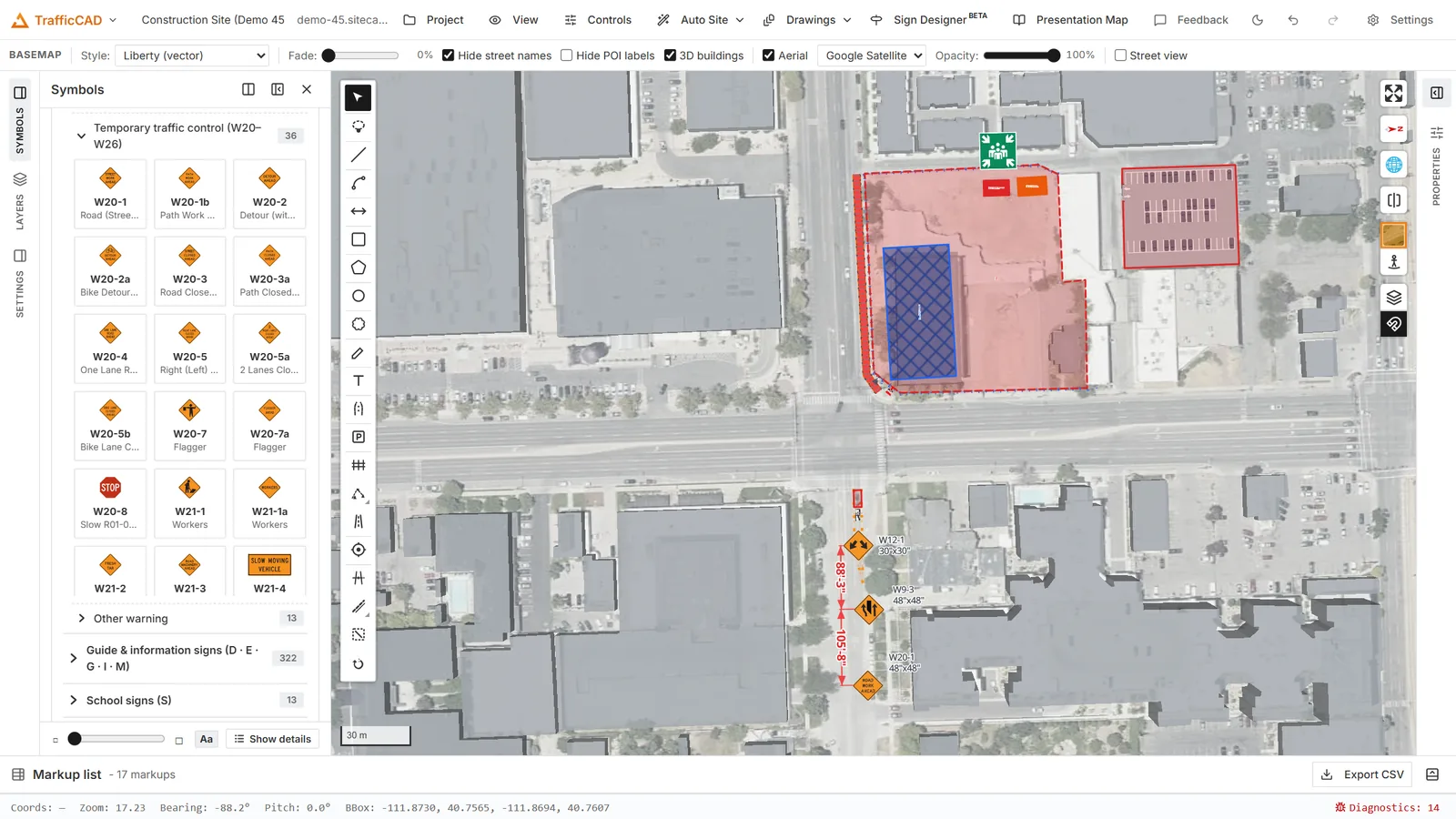
The Aerial imagery view: markups stay vector-crisp over the provider's photography.
Toggle imagery with the on-map Aerial imagery button (also in the TCP menu, or the Show aerial imagery checkbox in the Basemap panel). All of its settings live in the Basemap panel on the right rail — the entry directly under Properties:
- Source — the provider catalog, each with an honest note:
- Esri World Imagery — global high-resolution; print-friendly with attribution.
- Google Satellite — often the most recent capture; check Google's terms before publishing drawings.
- Google Hybrid (default) — satellite plus road/label overlay; good for orientation, busy under markup.
- USGS NAIP (US) — public-domain US aerials; safest for published drawings, softer at site zooms.
- Looks — one-click grading: Original, Crisp, Drafting (the lightened, desaturated Bluebeam-style wash that keeps markups readable — the default), Mono.
- Sliders — Opacity, Brightness, Contrast, Saturation.
- Hide street labels — the shared label setting, surfaced here too: besides hiding the vector basemap's labels, it swaps Google Hybrid to its label-free satellite tiles so the photography goes quiet as well.
- AI helpers (the Aerial AI clean-up section) — Clean up view (AI) and Detect & mask cars/trees (SAM) for decluttering the base before a capture; Reset restores.
Adjustments are applied on the GPU as raster paint, which means the sheet captures inherit exactly what you see — no separate export grading.
The Basemap panel
The Basemap panel also controls the default (vector) basemap itself:
- Basemap style — switch between the OpenFreeMap vector styles (Liberty, Positron, Bright, Dark, Fiord) and full-imagery basemaps from the same provider catalog.
- Appearance — Fade basemap (a white wash that mutes the base so plan content pops, Bluebeam-style), Hide street labels, Hide business & POI labels (shop/restaurant/building names and house numbers go quiet while street and place names stay), 3D buildings on/off with a Massing opacity for the grey massing shown over aerial imagery, and a Tilt slider for the camera. 3D buildings work on every vector basemap style (TrafficCAD adds the massing to styles that don't ship it). Fade and label settings bake into drawing-sheet captures, so sheets print exactly this look.
- Street view — toggle the Mapillary street-level coverage (see below).
Street view
Directly under the on-map Aerial imagery button sits the Street view (Mapillary) button — one click adds the green coverage lines/points and opens the photo viewer panel; click any covered street to review the site at eye level, with your placed signs, devices, and work areas rendered into the photography in 3D. Coverage is a review aid only: it is never included in drawing-sheet captures or exported PDFs.
Imagery on sheets
Every drawings viewport chooses its Basemap: the default map style or Aerial imagery. Satellite viewports get their own Imagery (this viewport) override panel — source and sliders layered on the global settings (with a Reset back to global) — so the cover sheet can run full-color imagery while detail sheets use the Drafting wash. Tuning the look recaptures affected viewports automatically.
The 3D camera
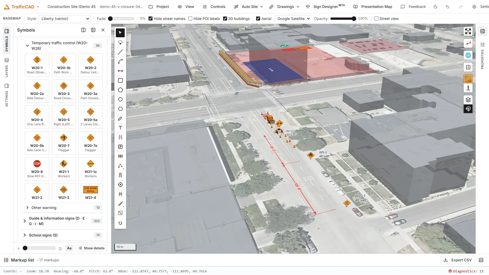
Tilt the camera and signs stand up — panels hold their heading and mounting height in true 3D.
Rotate with the right mouse button, tilt with Ctrl-drag (see Interface). As the camera pitches:
- Signs stand up — camera-facing or holding their true heading, at mounting height when a mount is shown — see Sign Display.
- Devices become models — cones, drums, panels, barricades, arrow boards, and vehicles as true Figure 6K-1-scale meshes, in channelizer runs and TTC plans alike.
- Fences stand — posts, fabric, and privacy screens (Fencing).
- Extruded markups rise — any closed markup with a 3D extrusion.
Every feature's 3D behavior has a per-object toggle, so a plan-only workflow never has to see a mesh.
3D on sheets
The Drawings workspace 3D inset item captures a pitched perspective (55° tilt, satellite basemap) captioned "3D VIEW — NOT TO SCALE" — the pedestrian-management or context inset agencies like, sitting next to a plan viewport that keeps its exact engineering scale.