Event Planning Mode
One switch turns TrafficCAD from a traffic-control drafting board into an event site planner: zones with automatic areas, circulation routes, parametric walking paths, a parking-lot generator, and a catalog of event objects — tents, stages, toilets, generators, barriers — all on the same live map, sharing the same layers, sheets, and exports.
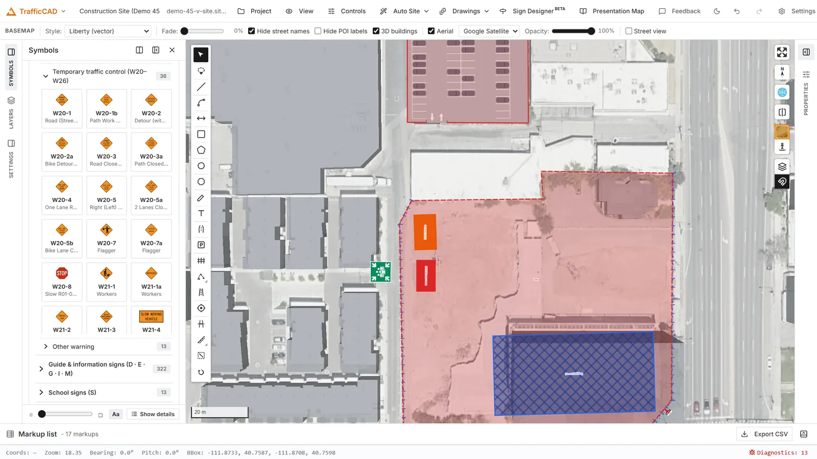
Zones with live areas over real imagery — the same tooling serves an event site and a construction compound.
Switching workspaces
At the top of the Tool Chest, the Workspace section has two buttons:
- Traffic control — MUTCD signs, devices, roads, TA plans
- Event planning — Site objects, zones with m², routes, walking paths
The mode persists with the project. Switching swaps the toolbar's mode-specific tools, the symbol catalog, and the unit system — event mode works in metres and square metres; traffic mode in feet and mph. Event mode also surfaces a Share live map… button (see Sharing & Collaboration) — safety officers review event layouts more often than they draw them.
Zones
Three tools: Zone polygon, Zone rectangle, and Zone circle (click the center, then the radius). Every zone measures and labels its own area in m².
Zone kinds carry ready styling: Parking, Camping, Crowd area, Restricted zone, Tent area, Stage / production, Vendor area, Medical / welfare, and Custom zone. The Selected zone editor changes the kind, the label text, the m² label visibility, and (for circles) the radius — with the measured area always shown.
Routes
The Route tool draws circulation with automatic length labels in metres. Kinds: Pedestrian route, Vehicle route, Emergency route — each styled distinctly so an event control plan reads at a glance.
Walking paths
The same parametric walking paths as traffic mode — width, surface (including trackway/matting for turf), rope/barrier/fence edges, one-way flow arrows, and the Accessible width check — measured in metres here.
The parking-lot generator
Draw a boundary with the Parking lot tool (or right-click any closed polygon → Convert to parking lot) and stalls fit themselves inside:
- Stall angle — 90°, 60°, 45°, 30°, or parallel; stall width / depth and aisle width (blank = the code-real minimum for the angle, so drive aisles are never orphaned).
- Row bearing — auto-aligns to the longest edge, or set it; rows lay out as double-loaded modules (stalls–aisle–stalls).
- Stall editing — click stalls on the map to remove them (click again to restore) or mark them accessible; edits survive re-layout.
- Entrances & drive lanes — arm Add entrance and click the boundary (or right-click the lot → Add entrance here) to mark a driveway: the outline opens at the curb cut, in/out arrows paint per the opening's Two-way / In only / Out only flow, and its width is editable per entrance. Once an entrance exists, cross aisles connect every parking aisle into one circulation network (Auto lays them at the row ends and then adds whatever connectors an irregular shape needs — arms, notches, staircase cuts; add your own with Add drive lane, and drag an entrance's blue grip to slide it along the boundary). Stalls under a lane are culled automatically, and the layout guarantees access: a spot no driver could reach from an entrance is left out and counted — "12 stalls were left out — no drive-lane route from an entrance reaches them" — never drawn as a stall that can't be used (an isolated area just needs its own entrance or drive lane to fill back in). Echelon (angled) lots get one-way aisle arrows, with an optional Serpentine flow that alternates direction per aisle.
- Vehicles — optional car glyphs (a realistic mix of compacts, sedans, SUVs, vans, trucks) with an occupancy slider. The mix is deterministic — it doesn't reshuffle every time the layout updates.
- The count line totals it: "142 stalls (6 accessible) · 2 entrances · area 3,480 m²".
The event object catalog
In event mode the Symbols browser swaps to the event catalog ("Search event objects (tent, stage, toilet…)"), organized as:
- Tents & structures — tents, marquees, stages, DJ risers, LED screens
- Vendors & hospitality — bars, food stalls, kiosks, ticket booths, merch, info points
- Sanitary & welfare — WCs, accessible WCs, toilet blocks, showers, water points, waste
- Power & infrastructure — generators, distribution boards, water tanks, fuel bunds
- Access & safety — Heras fence, mojo barriers, gates, turnstiles, security posts
- Vehicles & trailers — campervans, trucks, trailers
Objects place at true ground size, stand up in 3D, and count in the legends and markup list like any symbol.
Info popups for the ops plan
Attach an Info popup to anything — a stage, a gate, a generator — with a title and key/value fields (Capacity, Contact, Schedule, Supplier, Power, Notes). Reviewers following a shared live-map link see them on click. See Markup Tools.
From site plan to deliverable
Everything event mode makes flows into the same outputs: metric scales and ISO paper sizes on sheets, the QR code sheet item so crews scan into the live map, fencing BOMs for the perimeter, and live sessions for the safety walkthrough — and the traffic side of the event (closures, detours, signage) is one workspace switch away.