Map Controls & Tools
The Controls menu toggles the on-map helpers: the standard map controls that sit in the corners, and the tool panels like Measure and Bookmark. A check mark next to an item means it is currently shown.
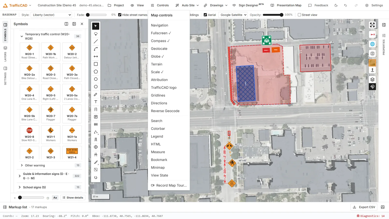
The Controls menu toggles the on-map helpers: search, measure, bookmarks, the minimap, and the rest.
Map controls
Controls → Map controls holds the controls that sit in the map corners:
| Control | Description |
|---|---|
| Navigation | Zoom in/out buttons. |
| Compass | Shows the current bearing; click to reset north. |
| Fullscreen | Expand the map to fill the screen. |
| Geolocate | Center the map on your current location. |
| Globe | Switch between the flat map and a 3D globe projection. |
| Terrain | Toggle terrain (3D elevation) rendering. |
| Scale | Show a scale bar. |
| Attribution | Show data attributions. |
| TrafficCAD logo | Show or hide the logo watermark. |
Tools
The rest of the Controls menu toggles interactive panels:
| Tool | Description |
|---|---|
| Search | Search for an address or place and fly to the result. |
| Measure | Measure distances and areas interactively. For dimensions that stay on the plan and print, use Dimensions & Callouts instead. |
| Bookmark | Save named map views and jump back to them. |
| Minimap | Show an overview map of the current extent. |
| View State | Read and edit the exact center, zoom, bearing, and pitch. |
| Gridlines | Overlay a latitude/longitude graticule. |
| Directions | Route between two points on the street network. |
| Reverse Geocode | Click the map to get the nearest address. |
| Legend | Show a legend describing the layers on the map. |
| Colorbar | Display a continuous colour scale for raster values. |
| HTML | Display custom HTML content in an on-map panel. |
| Record Map Tour... | Record a camera fly-through of the map as a video. |
Printing the map view lives under Project → Print Layout.
Measure vs. dimensions
Measure is a scratch tool — the readout disappears when you clear it. A dimension is a real plan object: it snaps to signs, devices, and road geometry, follows them when they move, and prints on the sheet.
Map navigation basics
- Pan: drag the map.
- Zoom: scroll wheel, pinch, or the navigation control.
- Rotate: hold the right mouse button and drag, or use the compass.
- Tilt: hold
Ctrl/Cmdand drag to tilt the map into a perspective view.
The View menu adds precise camera control: Zoom In / Zoom Out, Previous view / Next view, Reset orientation (pitch, bearing, or both), Set View… for exact coordinates, Split View for a synced side-by-side comparison, Show grid, and Basemap settings….