Projects
A TrafficCAD project captures your whole workspace in a single .sitecad.json file: the map view, the basemap, every layer with its source and style, all your markups, signs, devices, roads, and plan sheets, and your map preferences. Open it again and you are exactly where you left off.
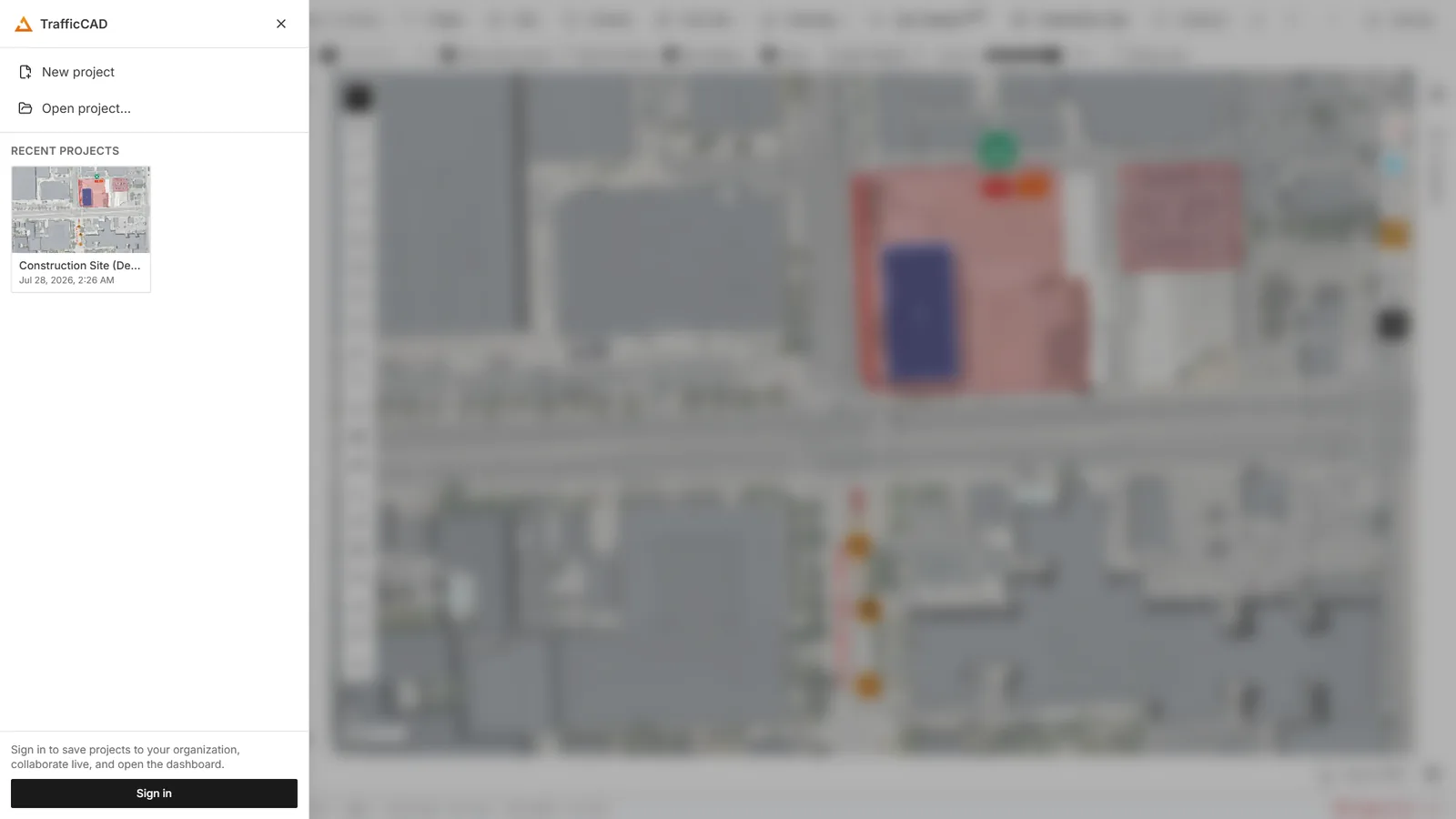
The TrafficCAD menu — your organization's cloud projects, everything you have opened recently, and the route to the Dashboard.
There are two places to work with projects: the TrafficCAD menu (the brand button at the far left of the toolbar) for your organization's cloud projects and recent files, and the Project menu for file operations.
The TrafficCAD menu
The brand button at the far left of the toolbar — "Projects, recents, and your account" — opens the project hub. It is the fastest route to everything you have worked on:
| Item | What it does |
|---|---|
| New project | Starts a fresh, empty project. |
| Open project… | Opens the file picker. |
| Save to TrafficCAD Cloud | Uploads the current project to your organization so teammates can open it. |
| {organization} projects | Every cloud project in your organization, newest first, each showing when it was last updated and by whom. Click one to open it. Refresh re-reads the list. |
| Recent projects | Projects you have opened or saved, with a small remove button on each row. |
| Dashboard | Opens your account dashboard — seats, billing, and team management. |
| Switch organization | If you belong to more than one workspace, changes which one you are working in. |
| Manage / Sign out | Account settings and sign-out. |
If you are signed out, the hub shows a prompt to sign in — cloud projects, live collaboration, and the dashboard all require an account.
Cloud projects are per organization
A cloud project belongs to the workspace it was saved into, not to you personally. Everyone in that organization can see it, and what they can do with it depends on their role — Owner, Admin, Editor, or Viewer. See Sharing & Collaboration.
The Project menu
New
Project → New... starts a fresh project. TrafficCAD offers to save the current project first, then resets the layers, map view, and controls to defaults.
Open
Project → Open From has three sources:
- File... opens a
.sitecad.jsonfile from disk. - URL... loads a project from an HTTP or HTTPS URL. This works in the browser too and adds the project to your recent list.
- Sample projects... opens the example library — see below.
Project → Open Recent lists the projects you have opened before, each with its name, path, and the time you last opened it. Click an entry to reopen it, use the small remove button to drop a single entry, or choose Clear Recent Projects to empty the list.
Sample projects
Project → Open From → Sample projects... opens the example library: complete, ready-made TrafficCAD projects you can explore, learn from, or use as a starting point. The same list is on Dashboard → Projects → Featured.
Press Open a copy on any card. The sample loads as a new, unsaved copy — change anything you like, and the original is untouched for everyone else. Save it to your own workspace when you want to keep your version.
Two ship to start with:
- Lane closure — traffic control plan — a curb-lane closure on a five-lane arterial, with a computed merging taper, buffer space, a drum run at code spacing, advance warning signs, and dimensions.
- Construction site — site plan — a fenced compound with laydown, offices, welfare and parking zones, a haul route, and site-safety and fire signage.
Learning from a sample
Samples are the fastest way to see how a finished plan is put together. Open one, click a road to see its lane diagram, select the channelizer run to see its taper settings, and expand the Markup list to see every object with its measurement. Then delete things and rebuild them — you cannot break anything, because you are working on a copy.
Loading a project at startup
You can open a project directly by passing its URL with the url query
parameter, for example ?url=https://example.com/plans/main-st.sitecad.json.
Saving your work
The Project menu offers three ways to save:
- Save to TrafficCAD Cloud saves the project to your organization's cloud workspace, where it appears on the dashboard and is available to your team. If the project is already a cloud project, this saves it in place.
- Save As... saves a copy of the project to TrafficCAD Cloud under a new name — you are prompted to name the copy, and the original is not changed.
- Save a Local Copy... writes a portable
.sitecad.jsonproject file to your machine. In the browser this downloads the file; on the desktop app it writes to the path you choose.
Every save captures the current map view, basemap, layers, styles, plan objects, markups, and sheets at the moment you save. Ctrl+S saves a cloud project back to the cloud (and a file-based project back to its file); cloud projects also autosave in the background every 30 seconds while you work.
Collaborate
Project → Collaborate... opens a live session so teammates can edit the same project at the same time. It is available on the Complete tier and above; on other plans the item shows a tier chip and offers an upgrade. See Sharing & Collaboration.
Print Layout
Project → Print Layout... exports the current map view to a PDF or image with a page size and orientation of your choosing. This is a quick print of the map itself — for titled, scaled plan sheets with a title block and schedules, use the Drawings workspace and PDF export instead.
Bringing your own data in
Drag a file from your desktop onto the map and TrafficCAD imports it as a layer. A status message reads Importing data... while the file is parsed, and the finished layer appears in the Layers panel where you can rename, reorder, restyle, or hide it.
| Kind | Extensions |
|---|---|
| CAD | .dxf |
| Vector | .geojson, .json, .shp (with its sidecars, or a .zip), .gpkg, .kml, .kmz, .gml, .gpx, .tab |
| Tabular | .csv, .tsv with coordinate columns |
| Cloud-native | .parquet / .geoparquet, .fgb / .flatgeobuf |
| Raster | .tif, .tiff (GeoTIFF / COG) |
| OpenStreetMap | .osm.pbf extracts |
Dropping a .sitecad.json file opens it as a project rather than importing it as data.
Imported layers are reference data — a survey, a utility set, a parcel boundary you are designing against. They sit underneath the plan objects you draw and ride along in the saved project.
Large OSM extracts
Dropping a big .osm.pbf file warns you first with its size, because
parsing a large extract can use a lot of memory. For street geometry you
almost always want Auto Site instead — it pulls just the corridor you
are working on and returns editable, parametric roads rather than raw
lines. See Roads, Vectorize & Site Modeling.